5585 Guilford Road • Madison, WI 53711-5801 • 608-273-8080 • Fax 608-273-2021
www.agronomy.org
Twitter | Facebook
NEWS RELEASE
Contact: Hanna Jeske, Associate Director of Marketing and Brand Strategy, 608-268-3972, hjeske@sciencesocieties.org
The fingerprints of coastal carbon sinks
Nov. 1, 2017 - Did you know carbon comes in blue?
 Blue carbon refers to the carbon in oceans and coastal areas. These ecosystems are excellent carbon sinks – they can efficiently absorb and store carbon from the atmosphere.
And with global emissions of carbon dioxide topping 35 billion tons in 2016, carbon sinks are more important than ever.
A new study highlights a technique that could be used to accurately measure levels of soil carbon in coastal carbon sinks, such as mangrove forests.
“Being able to measure soil carbon levels accurately and economically is vital for mangrove restoration projects and other conservation initiatives,” says Gabriel Nóbrega, an author of the new study.
In the past, researchers have used the technique – diffuse reflectance spectroscopy, or DRS – to measure carbon in dry soils. “Few studies have tested it in coastal wetland or mangrove soils,” says Nóbrega, a researcher at the University of São Paulo in Brazil.
Researchers have found it challenging to measure exact levels of soil carbon in coastal areas, such as mangrove forests. Traditional methods to measure soil carbon levels were developed for dry soils. Not all of them work in the wet soils of mangrove forests.
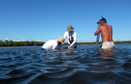
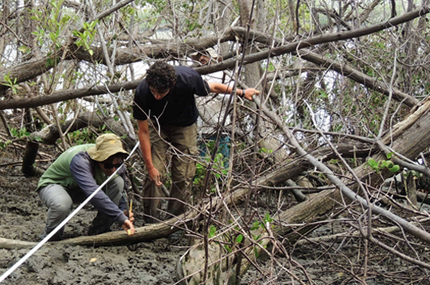
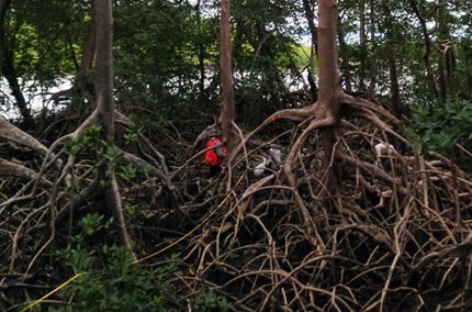
 Nóbrega and his colleagues tested DRS on soil samples from three mangrove forests in northeastern Brazil.
They found that DRS may be a more accurate and efficient method compared to more conventional approaches to determine carbon levels in mangrove soils.
In addition to higher accuracy, using DRS to measure soil carbon levels has other benefits. Conventional methods can be expensive, time-consuming, or toxic. “DRS is fast, non-expensive, and non-toxic,” says Nóbrega. “That makes it possible to take more measurements and be more precise.”
DRS technology works in a similar way to how we see. Light from a source, like the sun, hits an object, say a flower. Some part of the light is absorbed and some part reflected. The light that is reflected is captured by our eyes. Our eyes act like sensors, and voilá! We see a blossom.
And with DRS? Researchers target a soil sample with light of a known wavelength, usually 350-2500 nanometers. This light interacts with soil compounds, including organic carbon and other elements. Sensors capture the reflected light, which researchers can use to create reflectance fingerprints.
These reflective fingerprints are important. “Using these fingerprints, we can study soil properties and measure levels of carbon without having to do chemical analyses,” Nóbrega explains.
 DRS may be more accurate than conventional techniques when measuring the carbon content of wet mangrove soils. These soils are often saturated with water. That can lead to relatively low levels of oxygen. The chemical reactions that take place in low-oxygen environments can ultimately throw off carbon measurements made using conventional methods.
While the initial results using DRS have been encouraging, Nóbrega says there is still much work to be done. For example, mangrove forests across the world are highly variable. Their soils may differ in various characteristics, such as grain size and salt or mineral content. Researchers will have to account for these differences when using DRS to measure levels of carbon.
Nóbrega hopes to build a library of soil reflectance fingerprints for mangrove soils throughout the world. He doesn’t want to stop with mangrove soils, though. “Ultimately, we want to expand to other coastal environments, such as saltmarshes, seagrasses, and tidal flats,” he says.
Eventually, it might be possible to equip a drone with the required sensors. “Then we could obtain vital information without disturbing sensitive ecosystems,” says Nóbrega. “We could monitor carbon levels in large, inaccessible areas.”
Read more about Nóbrega’s work in Soil Science Society of America Journal. Funding was provided by Sao Paulo Research Foundation (FAPESP), Conselho Nacional de Desenvolvimento Científico e Tecnológico (CNPq) and Coordenação de Aperfeiçoamento de Pessoal de Nivel Superior (CAPES).
Soil Science Society of America Journal is the flagship journal of the SSSA. It publishes basic and applied soil research in soil chemistry, soil physics, soil pedology, and hydrology in agricultural, forest, wetlands, and urban settings. SSSAJ supports a comprehensive venue for interdisciplinary soil scientists, biogeochemists, and agronomists.